
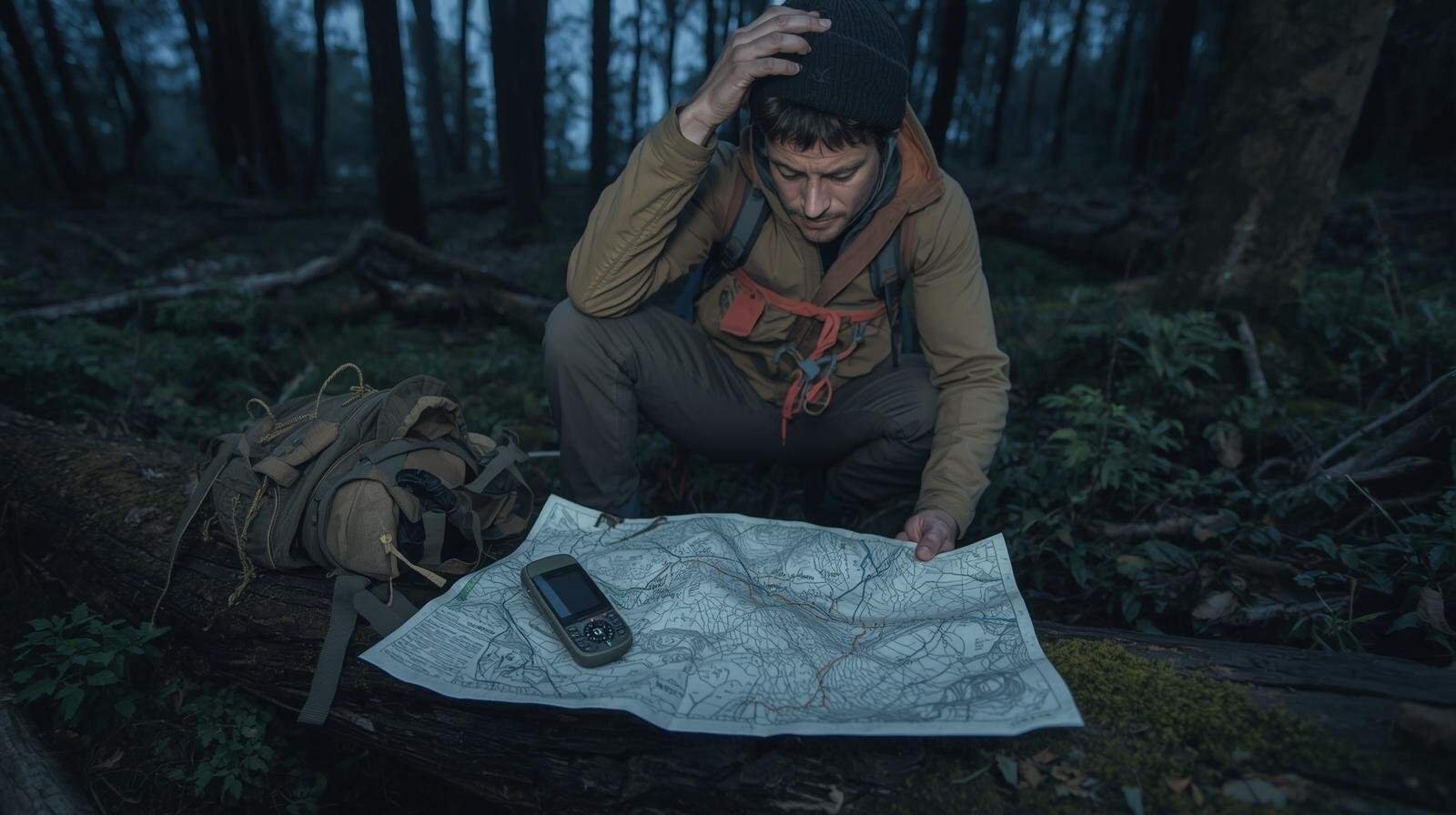
The “Lost” Case Study: 5 Common Land Navigation Mistakes That Can Kill You
It usually starts the same way. I’ve seen it a hundred times, and honestly, it’s getting old.
“I’ll just take a quick loop.” “I know this area like the back of my hand.” “My phone’s got a map and 12% battery, I’m golden.”
Three hours later, the sun is sliding behind the ridge, that phone battery is dead, and every tree looks like it’s mocking you. Suddenly, the woods don’t feel like a playground; they feel like a cage.
Here is a hard truth from someone who has spent decades tracking through the brush: Search and Rescue (SAR) teams don’t spend their weekends rescuing “reckless idiots.” Most of their callouts involve competent, intelligent people who made a few small, technical errors that quietly stacked into a life-threatening crisis. That’s why understanding land navigation mistakes matters infinitely more than owning the latest tactical GPS watch or high-speed gear.
Land navigation isn’t about having a map. It’s about interpreting that map under stress, fatigue, bad weather, and the creeping realization that you might be sleeping on a pile of wet leaves tonight. It’s about thinking clearly when your comfort zone evaporates.
Getting lost is rarely bad luck. It’s usually a chain of specific, repeatable, and completely fixable land navigation mistakes. In my experience, if you can eliminate these errors, you eliminate 90% of the risk.
So, grab your compass and listen up. Let’s break down the five most dangerous land navigation mistakes that I see people make over and over again.
Mistake #1: The “Dominant Leg” Drift (Lateral Drift)
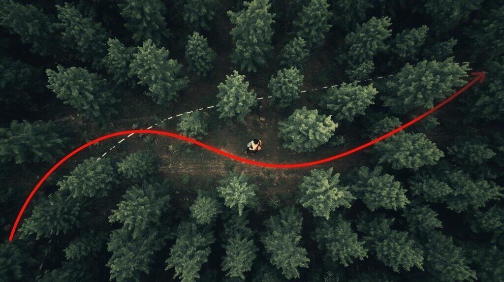
If you think you can walk in a perfectly straight line through the woods without visual references, congratulations. You are confidently incorrect. This is one of those land navigation mistakes that feels impossible until you look at your GPS track later and realize you walked a perfect circle.
The Science Behind the Drift
Here is the biology: Humans are asymmetrical. One of your legs is stronger. One hip rotates a fraction more than the other. One shoulder swings a ruck slightly wider. When you have visual landmarks, your brain subconsciously corrects this. But when the fog rolls in, or the canopy gets thick and the visual landmarks disappear, those tiny imbalances compound.
The result? You drift.
Studies on human orientation in the absence of visual cues show that people walking “straight” in featureless terrain tend to walk in loops. Sometimes they are tight circles; sometimes they are gentle, agonizing arcs that slowly carry you miles off course. I’ve done it. You’ve done it. It is one of the classic land navigation mistakes because it’s biological, not intellectual.
The Result: Big Circles, Small Hope
You think you’re moving North. You are swearing on your mother’s grave that you are moving North. In reality, you are carving a graceful crescent back toward where you started, but three miles to the East. Fatigue makes it worse. Stress makes it worse. Darkness turns it into a wandering contest you will not win.
The Fix: Aiming Off and Steering Marks
Professional navigators don’t “walk straight.” We leapfrog. To avoid these land navigation mistakes, you need to stop trusting your legs and start trusting your eyes.
Here’s how I do it:
- Pick a clear landmark 30 to 50 meters away in your bearing line. A distinct tree, a weird rock, a stump.
- Walk directly to it.
- Stop.
- Pick another landmark.
- Repeat.
You are creating a chain of visual anchors. For longer travel, use “aiming off.” Intentionally aim slightly left or right of your target so you know which way to correct when you hit a linear feature like a road or stream. Control beats confidence. Every single time.
Mistake #2: The Grid vs. Magnetic Disconnect (Declination)
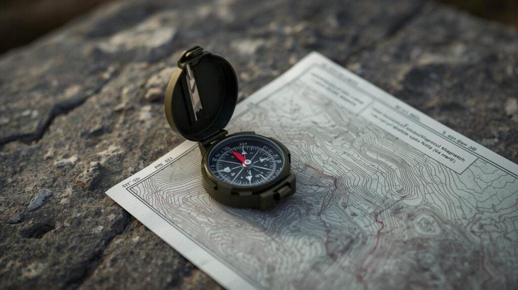
This is the king of silent killers. Of all the land navigation mistakes on this list, this is the one that makes you feel the stupidest once you figure it out. If you misunderstand declination, you are walking confidently, with purpose, in the completely wrong direction.
The Concept: Grid North vs. Magnetic North
Maps are oriented to Grid North (true north based on the map projection). Compasses point to Magnetic North (where Earth’s magnetic field currently points). They are not the same. The angle between them is called declination or the Grid-Magnetic angle.
When people ask for “magnetic declination explained,” I tell them this: It’s the difference between where the map says you should go and where the compass tells you to go. Ignoring this is one of the most fatal land navigation mistakes you can make.
The Error: Ignoring the Numbers
In some parts of the US, like up in Washington state or even parts of Arkansas, the declination can be significant. If you ignore it, you are doomed.
Let’s do the math. If the declination is 15 degrees and you walk six miles without correcting for it, you can be over a mile off target. One mile in wilderness terrain—especially in the dense brush of the Ouachitas or the Rockies—is the difference between “slightly lost” and “spending three days eating crickets.”
Most beginners commit these land navigation mistakes by either:
- Ignoring declination entirely.
- Guessing the angle.
- Setting it backwards (Subtracting instead of Adding).
- Forgetting to reset their compass after traveling to a new zone.
The Fix: Know Your Angle
Check the declination diagram on your map. It’s usually in the legend. You can also look up current declination on the NOAA Magnetic Field Calculator.
Classic rule:
- West is Best (You add West declination to your grid azimuth).
- East is Least (You subtract East declination from your grid azimuth).
Better rule: Buy a compass with an adjustable declination screw, set it once for your area, and forget about the math. Land navigation mistakes often happen because we try to do math while tired and dehydrated. Remove the math, remove the mistake. Declination is boring. Being lost is exciting in the worst way. Choose boring.
Mistake #3: Confirmation Bias (Bending the Map)
This is the psychological landmine. It gets smart people killed. It gets experienced trackers turned around. It is one of the insidious land navigation mistakes because it happens entirely in your head.
The Psychology: “This Must Be It”
You are tired. You want to be at Point B. You need to be at Point B. So your brain starts editing reality to fit your desires.
“That little rise? That must be the hill on the map.” “That dry ditch? That’s probably the stream, it’s just dry season.” “That clearing feels right.”
You are no longer navigating. You are negotiating with the universe. You are forcing the terrain to match the paper, and the terrain does not care about your feelings. This is one of the most common land navigation mistakes because it feels good while it’s happening. It feels like success—until it isn’t.
The Danger: Compounding Error
Once you “confirm” the wrong position, every single decision you make after that is based on a lie. Your next bearing is wrong. Your distance estimate is wrong. Your confidence is misplaced. This is how people walk deeper into trouble while feeling more certain they are on the right track. Avoiding land navigation mistakes like this requires a level of humility that most people struggle to muster in the woods.
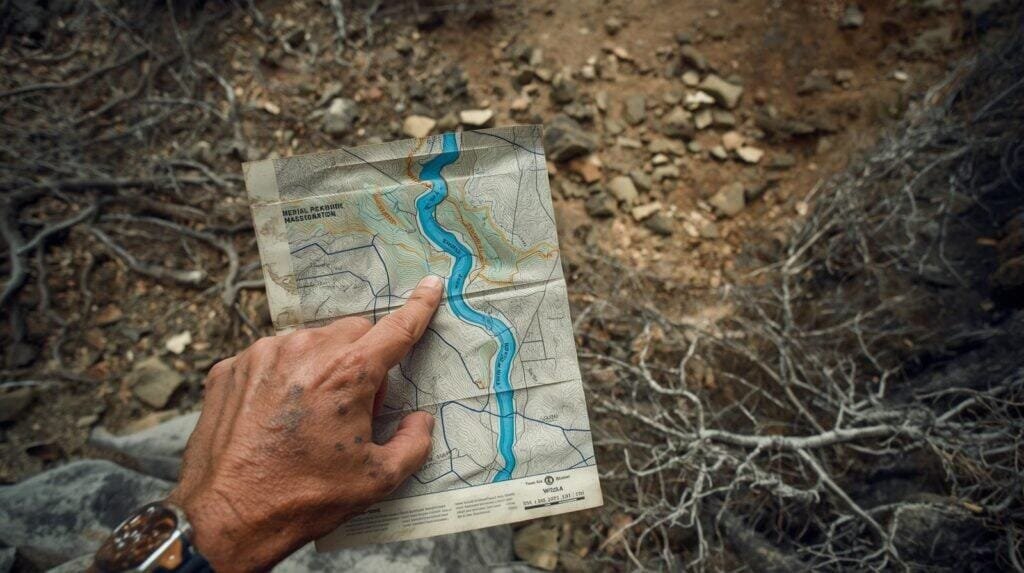
The Fix: Terrain Association
Terrain association means letting the ground lead. If the map shows two streams, a saddle, and a steep ridge, you must see two streams, a saddle, and a steep ridge. Not “kind of.” Not “close enough.” Not “probably.”
If the map says water and you see none, you are wrong. Stop. Reorient. Recalculate. Do not fall victim to land navigation mistakes born of arrogance. Hope is not a navigation tool. If the pieces don’t fit, don’t force them.
Mistake #4: The “Catch Feature” Failure (Overshooting)
This one looks simple. It isn’t. In fact, failing to identify a catch feature is one of the land navigation mistakes that turns a 2-mile hike into a 10-mile ordeal.
The Problem: No Stopping Plan
You shoot a bearing. You walk it. You pass your objective. And you keep walking. Why? Because you never decided where “too far” was. Without a stopping point, people walk straight past their goal and into the great unknown.
I’ve seen guys miss a campsite by 50 yards, but because they didn’t have a catch feature, they walked another three miles before realizing they screwed up. These land navigation mistakes burn calories and daylight—two things you cannot afford to waste.
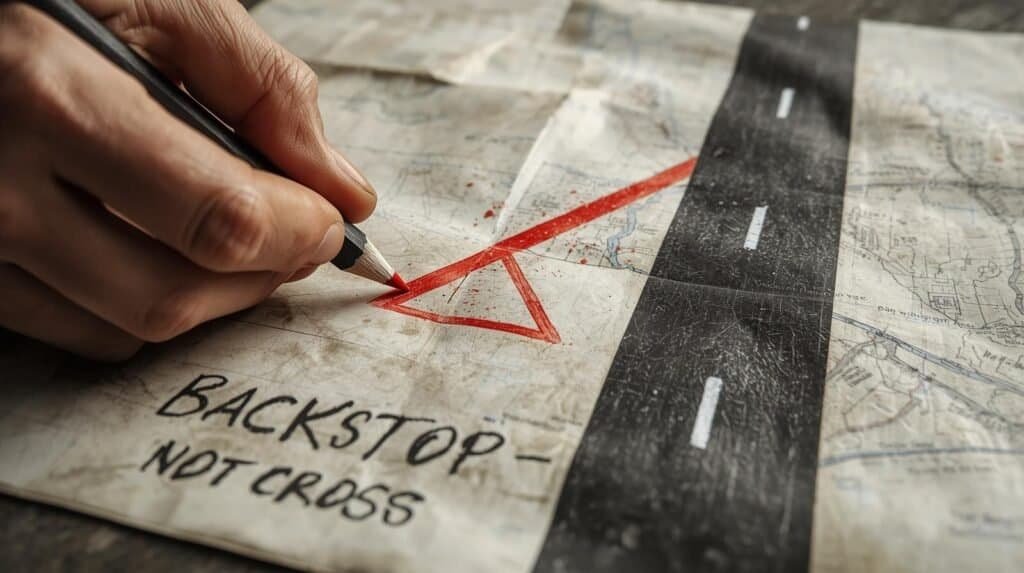
The Fix: Catch Features and Backstops
Before I ever step off on a bearing, I answer one question: “If I go too far, what will stop me?”
Examples of catch features:
- A major road
- A river
- A prominent ridgeline
- A power line cut
- A trail junction
That feature becomes your backstop. You walk until you hit your target, or you hit the backstop. Either way, you know exactly where you are. Professional navigators never travel without catch features. Wandering without boundaries is for tourists, and tourists make land navigation mistakes. Be a professional.
Mistake #5: Relying on Batteries (GPS Fragility)
GPS is a miracle. I use it. I love it. But relying on it exclusively is one of the most modern and dangerous land navigation mistakes you can make.
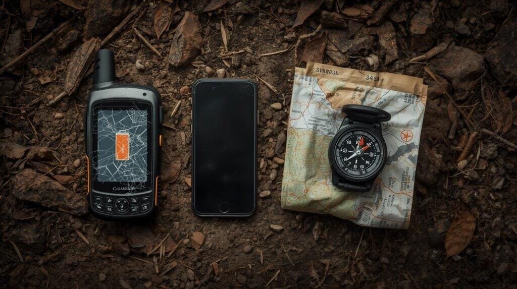
The Prepper Reality Check
Batteries die. Screens crack. Software freezes. Cold kills lithium performance. Moisture ruins charging ports. If your GPS unit or smartphone is your primary tool, you are renting your safety from a battery that was made by the lowest bidder. That’s not preparedness; that’s gambling.
I see so many “survivalists” who can’t read a topo map to save their life because they have OnX Hunt or Gaia GPS. Those apps are incredible, but they breed complacency. And complacency is the father of all land navigation mistakes.
The Real Role of Electronics
GPS should be:
- Verification
- Confirmation
- Backup
It should not be leadership. Your map and compass do the thinking. The GPS checks their homework. When electronics fail—and they will—nothing should change in your process. You should just shrug, put the phone away, and keep moving on your azimuth. That is the standard. If you can’t do that, you are setting yourself up for catastrophic land navigation mistakes.
Conclusion: Skill Beats Luck Every Time
Let’s recap the five deadly land navigation mistakes:
- Drifting in circles because of biomechanics.
- Ignoring declination and math.
- Bending reality to fit your hope (Confirmation Bias).
- Lacking catch features to stop your movement.
- Trusting batteries over hard skills.
Notice something? None of these land navigation mistakes require bad weather. None require extreme terrain. None require you to be incompetent. They just require neglect.
The fix isn’t more gear. You don’t need a $400 GPS watch to fix these land navigation mistakes. You need practice. This weekend, go to a park. Shoot a bearing. Walk it. Pace it. Miss it. Correct it. Learn. Build the muscle memory now, when failure is cheap and the stakes are low. Because out there in the backcountry? The stakes are ultimate.
Don’t let land navigation mistakes be the reason your wife has to call the Sheriff.
Frequently Asked Questions (FAQ)
Q: What is the most common of all land navigation mistakes? A: In my experience, lateral drift (Mistake #1) and confirmation bias (Mistake #3) are tied. People either walk in circles or they convince themselves they aren’t lost when they are. Both are among the most frequent land navigation mistakes I see.
Q: Can I just use my phone for land navigation? A: You can, until you can’t. Relying solely on a phone is one of the land navigation mistakes I preach against constantly. Use it, but have a paper map and compass as your primary or at least a redundant backup. Batteries die; paper doesn’t.
Q: How do I avoid magnetic declination errors? A: To avoid these specific land navigation mistakes, check your map’s legend for the declination diagram. Remember “West is Best” (add) and “East is Least” (subtract). Or, buy a compass that allows you to mechanically set the declination so you don’t have to do math in the field.
Q: Why do I walk in circles when I’m lost? A: This is one of the biological land navigation mistakes. Without visual cues, your body’s natural asymmetry (one leg stronger than the other) causes you to drift. Use a compass and “steering marks” (trees, rocks) to keep a straight line.
Q: What is a “Catch Feature” in land navigation? A: A catch feature is a prominent landmark (road, river, cliff) beyond your target that “catches” you if you overshoot. Failing to identify one is one of the land navigation mistakes that leads to people walking miles further than necessary.
Keep Your Skills Sharp
👉 Land Navigation for Real Life
👉 DIY Land Navigation Kit That Fits in Your Glovebox
👉 Your Phone’s Dead. Now What? Old-School Navigation
👉 Understanding Magnetic Azimuths: A Navigator’s Guide to Precision