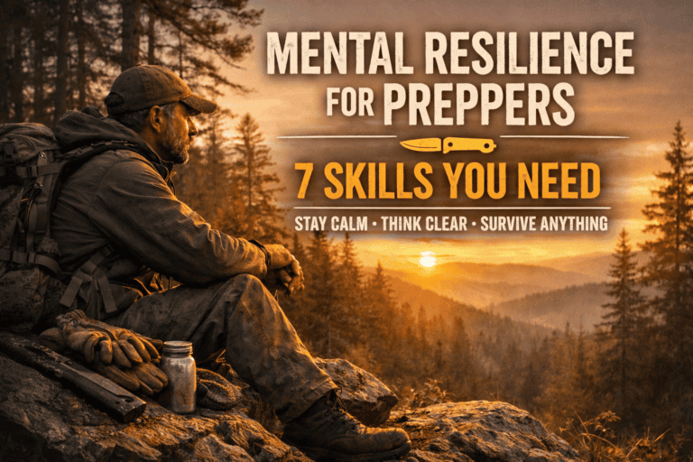
Land Navigation for Real Life: How Not to Get Lost and Cry in the Woods
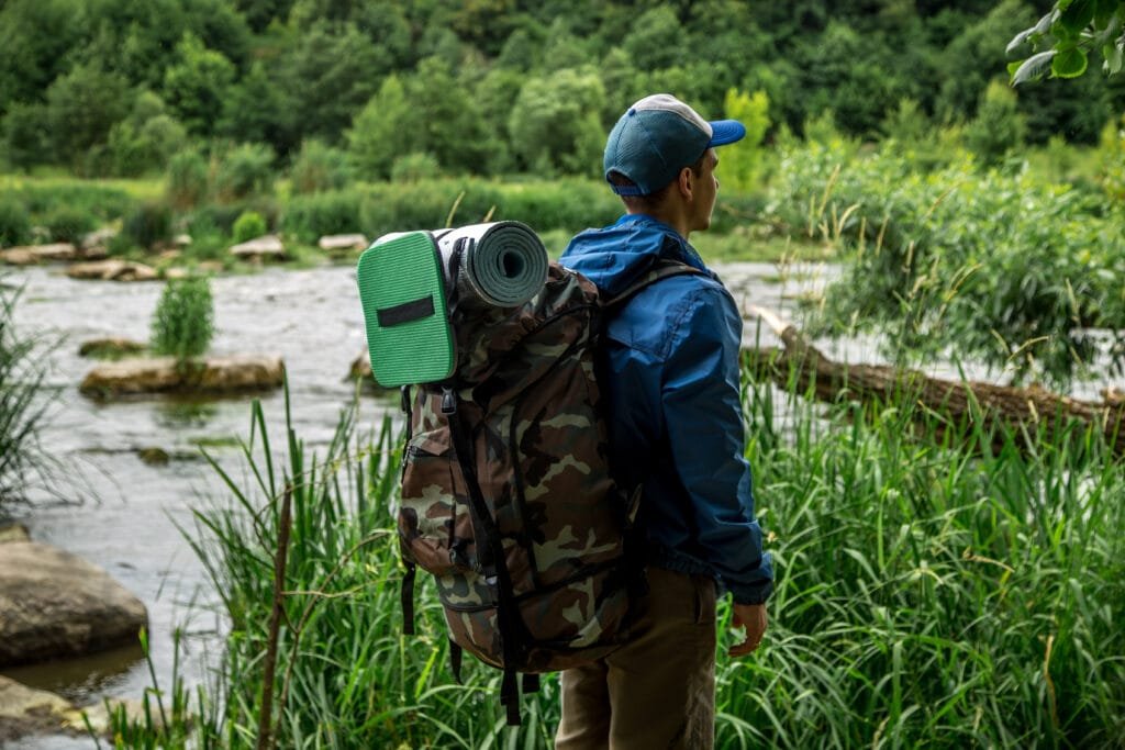
Whether you’re backpacking, hiking, or just pretending you’re on a Discovery Channel survival show with nothing but a granola bar and stubborn confidence, land navigation isn’t optional—it’s survival 101.
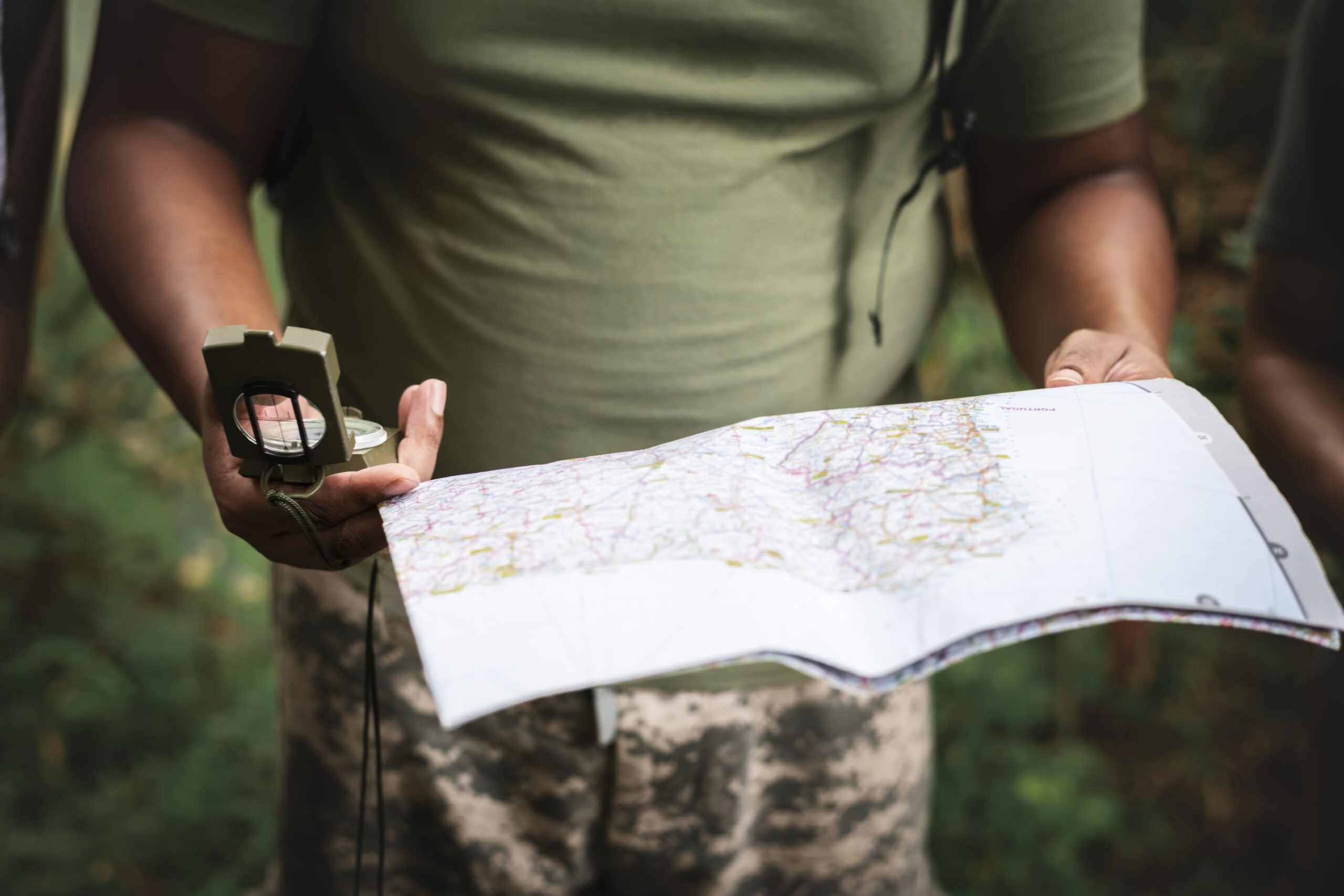
Sure, GPS apps are great—until the battery dies, your phone takes a swim, or the signal drops faster than your morale on mile 12 with a 40-pound pack. That’s when your compass, your map, and your brain step in. And trust me, if you’re only carrying one of those, you’re already flirting with a future rescue story.
In this post, we’ll walk through the essential land nav skills, how to level up from “weekend wanderer” to “I’ve got this,” and why sometimes the best training is getting humbled (and nearly frozen) by a Colorado whiteout.
I’ve been itching to write this one for a while, because land navigation isn’t just a skill—it’s a lost art that every modern adventurer and prepper needs to dust off. When the grid’s down, the GPS is toast, and your digital lifelines are dead, how will you find your way to safety—or even home?
That’s where old-school land nav comes in. So buckle up, grab your compass, and enjoy this deep dive into one of the most underrated survival skills out there.
Key Considerations for Successfully Navigating Off-Grid
Let’s get you pointed in the right direction—literally.
Whether you’re backpacking through dense forest or hiking in wide-open desert, navigation can go sideways fast if you’re not paying attention to a few key fundamentals. These are the small details that separate a confident adventurer from the guy arguing with squirrels about which way is north.
Declination Matters
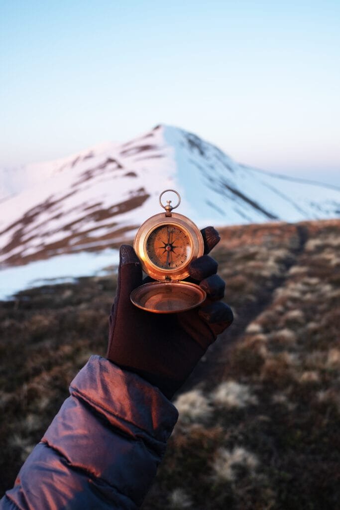
Let’s start with one of the most overlooked—yet most important—concepts in land navigation: declination.
Declination is the angular difference between true north and magnetic north at a specific location on Earth.
True north points to the geographic North Pole (the top of your map).
- Magnetic north is where your compass needle points, which is influenced by Earth’s magnetic field.
Simple Definition:
Declination is the number of degrees you must adjust your compass bearing to account for the difference between true north and magnetic north.
It’s measured in degrees east or west, changes depending on where you are on the planet—and slowly shifts over time.
In some places, this difference is barely noticeable. In others, it can be over 15 degrees. That might not sound like much, but even a small error can send you a mile or more off course over long distances. You don’t want to think you’re hiking toward your car only to end up at a cliff edge wondering if mountain goats take Apple Pay.
How to Fix It:
Find your local declination using NOAA’s magnetic calculator.
Once you know it:
- Adjust your compass (some have a built-in declination adjustment)
- Or manually correct it every time you take or follow a bearing
Adventure Wiser Tip:
Write your local declination in the corner of your map in permanent marker. Do it once, and never guess again.
Practice Makes Panic-Proof
Using a compass and map shouldn’t be your first move when you’re lost, freezing, and down to your last beef stick. That’s like reading the instructions for a parachute after you’ve jumped out of the plane.
Instead, practice before you need it—on familiar trails, in your local park, or even your backyard.
Here’s how to get started:
- 🔭 Shoot bearings between known landmarks (like a tree to a signpost)
- 🚶♂️ Walk the bearing, confirming you can follow it accurately
- ⏱️ Use your pace count to estimate distances between those points
- 📵 Try a no-phone hour—put it in airplane mode and rely only on your map and compass
💡 Think of this as a fire drill for your legs and brain. It builds your confidence and turns land nav from intimidating to instinctual.
⚠️ Why It Matters:
When real stress hits—weather turns, daylight fades, your trail app crashes—you want your body and mind to fall back on practiced skills. It reduces panic and helps you make smart decisions instead of survival bloopers.
Don’t Skip Pace Counting
Distance is just as important as direction in land nav. You might be heading the right way—but how far have you actually gone?
That’s where pace counting comes in.
It’s a way of tracking distance using the number of steps (or paces) you take over a known unit—usually 100 meters.
Here’s how to do it:
- Measure a 100-meter stretch (you can do this on a track or flat trail).
- Walk it naturally, counting every double step (left foot every time it hits the ground).
- That number is your 100-meter pace count.
Once you know your pace count:
- Multiply it to estimate distance covered
- Use it to confirm map distances while hiking
- Catch yourself if you overshoot a landmark
💬 Pro Tip:
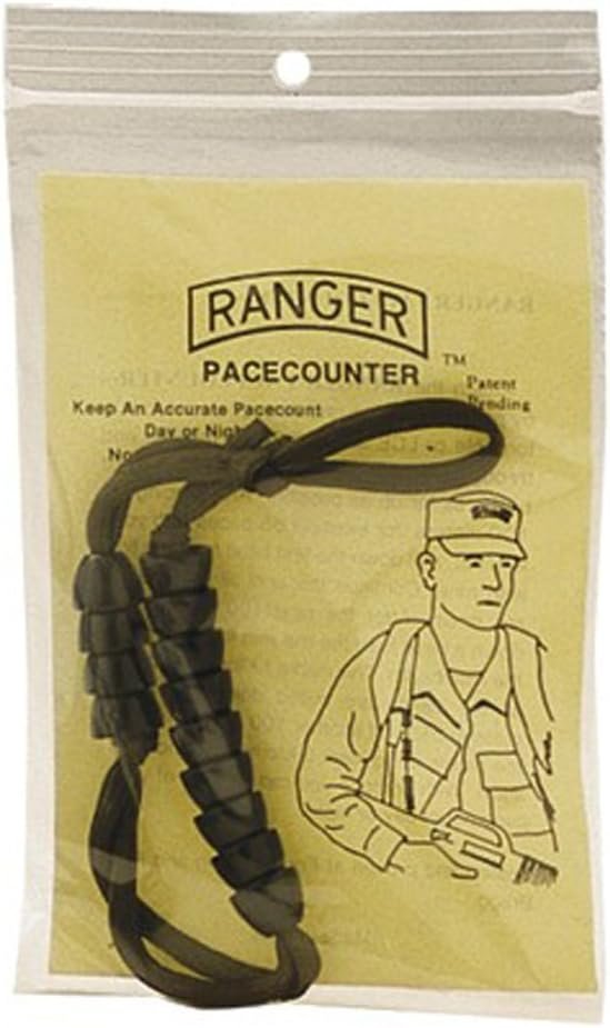
Use ranger beads (a string with sliding beads you move every 100 meters) to keep track on the go. If you don’t have beads, use pebbles in your pocket, knots in a string, or even tally marks on your glove with a Sharpie. The method doesn’t matter—the habit does.
Yes, you’ll look like a tactical forest goblin. But you’ll be a correctly-oriented tactical forest goblin who doesn’t need to call Search & Rescue.
Taking It to the Next Level: How to Improve Your Land Nav Skills
Got the basics down? Sweet. You can read a map, use a compass, and count your steps without tripping. Time to crank it up a notch—because real confidence comes from practicing in conditions that make your brain work harder.
Try Night Navigation
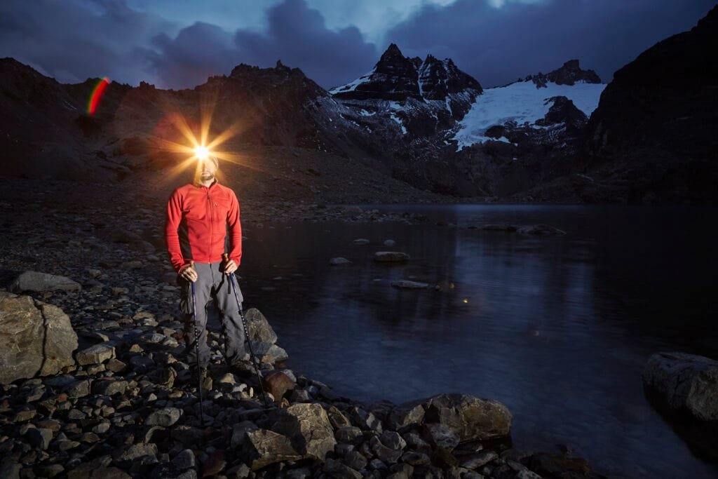
This one’s for the bold—or the forgetful (you know who you are). Navigating at night forces you to rely on your bearings, pace count, and terrain clues instead of easy visual landmarks.
Why it’s awesome:
- It teaches you to trust your compass when your eyes can’t cheat.
- You build confidence that you can navigate in less-than-perfect conditions.
- You’ll learn to move deliberately—no more sprinting through the woods like a caffeinated deer.
How to start:
- Head out on a familiar trail at dusk (start simple).
- Practice shooting bearings to visible landmarks like trees, rocks, or trail bends.
- Walk slowly and focus on keeping your bearing steady.
⚠️ Pro-level tip: Use a red-light headlamp. It preserves your night vision and prevents blinding your trail buddy every time you look their way. Nobody likes the friend who turns into a tactical lighthouse.
Add in Elevation Planning
Flatland nav is one thing. Throw in hills, and suddenly your neat little bearing lines look like a game of Chutes and Ladders.
What to focus on:
- Contour lines on topo maps. These squiggly brown lines are your best friends. Close lines = steep terrain; wide lines = gentle slope.
- Identifying terrain features like ridges, valleys, and saddles.
- Altimeter watches or apps to help track how high (or low) you are.
💬 Adventure Wiser Rule: If the map looks like a stack of spaghetti (a.k.a. contour lines packed together), it’s probably not a casual shortcut—more like a one-way ticket to calf burn and regret.
Beginner drill:
Pick a trail with elevation changes and track how the topo map matches the ground. Note when you climb, descend, or hit flat spots. Soon, you’ll start seeing the map in the landscape.
Practice Dead Reckoning
Dead reckoning sounds like something pirates used, but it’s actually one of the oldest, rawest nav techniques.
Here’s how it works:
- Pick a point on your map.
- Shoot a bearing with your compass.
- Walk that bearing—no trails, no shortcuts, no “oh look, a pretty creek” distractions.
You’ll learn to move with precision and keep track of distance and direction simultaneously.
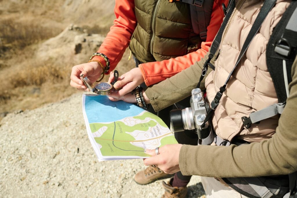
🎯 Pro Challenge:
Grab a buddy and take turns leading. The “leader” sets the bearing while the “tracker” double-checks progress with a map. Switch roles often. It’s like a trust fall—minus the bruised back.
Why it’s worth doing:
Dead reckoning hones discipline. It’s the difference between “I think I’m close” and “I know exactly where I am.”
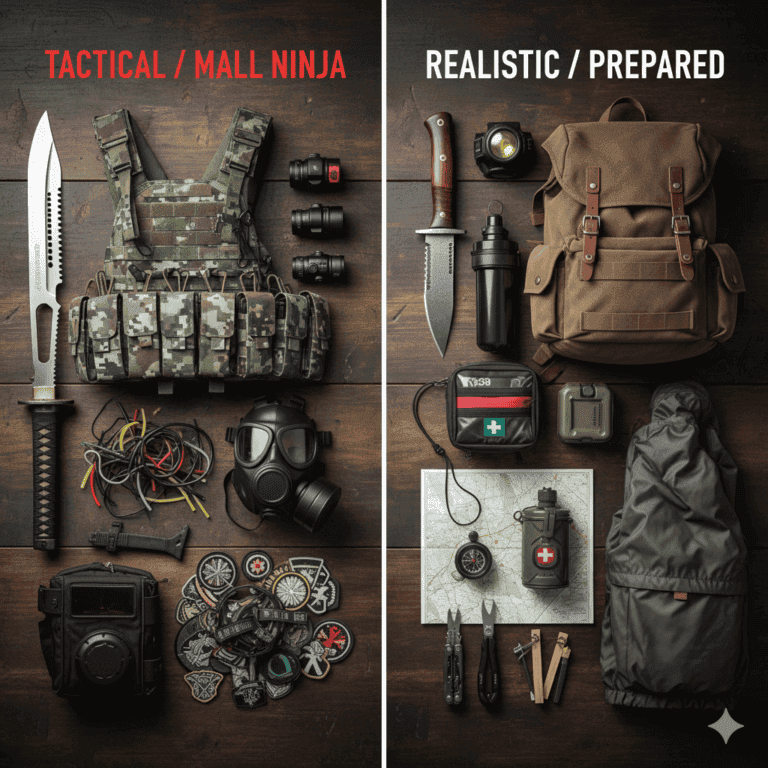
Alternatives to Traditional Land Navigation (a.k.a. Tech Crutches)
Look, we all love gadgets. But relying on them 100% is how you end up in a search-and-rescue headline. Tech should complement your skills—not replace them.
GPS Units
They’re reliable, rugged, and purpose-built for abuse. But if you forget extra batteries or drop it in a river, congratulations—you now own a $300 paperweight. Always pair it with a map and compass.
Smartphone Apps
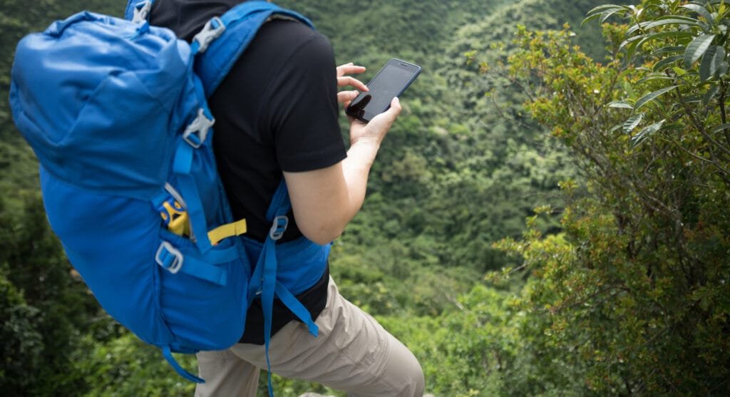
Smartphone apps: AllTrails, onX Backcountry, and others—just make sure to download offline maps before your hike. Otherwise, you’re basically carrying a digital paperweight with a camera.
- Download offline maps.
- Put your phone in airplane mode to save battery.
- Double-check that the app shows topographic detail, not just “green blob with dotted lines.”
Otherwise, you’re basically playing trail roulette.
Trail Markers & Signage
Trail markers are handy—when they exist. But they get knocked over, buried under snow, or stolen by pranksters. Treat them as helpful confirmations, not your main land navigation system.
The Bottom Line
Tech is a bonus tool—not your lifeline. GPS apps and satellite maps are great… right up until your battery dies, your screen freezes, or a storm knocks out the signal.
Learn to navigate with your own eyes, your own steps, and a good old-fashioned compass. That little magnetic needle doesn’t need a firmware update or a power bank.
Your brain and boots should always be your first line of defense.
Digital tools can supplement your skills—but they should never replace them. Because when tech fails (and it will), it’s your training, not your touchscreen, that gets you home.
In the wild, confidence doesn’t come from 5G—it comes from knowing you’ve got the skills to reroute yourself when the trail disappears.
Next-Level Training Challenges: Because Land Navigation Shouldn’t Just Work in Fair Weather
So you’ve learned to read a map, use a compass, count your steps, and not scream when your GPS says “No Signal.” Awesome. Now it’s time to take those skills out of the classroom (or cozy trail) and into the real world—where weather, stress, terrain, and adrenaline don’t care how many YouTube videos you watched.
These challenges are designed to push your skills, expose your weak spots, and most importantly, make you unshakable when things go sideways.
🌧️ Challenge 1: Rainy Day Reroute
What to do:
Wait for a rainy or foggy day (or simulate it with water-soaked gear) and attempt to navigate a short off-trail route using only your map and compass.
Why it matters:
Bad weather isn’t just uncomfortable—it kills visibility, makes terrain slippery, and makes paper maps a soggy disaster if they’re not protected. Watch this video from Ranger Survival and Field Craft to learn a better way to prepare a map.
💬 Adventure Wiser Lesson: If your plan only works in perfect weather, it’s not a real plan.
🌙 Challenge 2: Full Night Nav Simulation
What to do:
Start a hike just after sundown. Plot a course using bearings and pace counting only—no GPS, no glowing phone screen, and no trail unless absolutely necessary.
Add this twist:
Have your buddy hand you a waypoint mid-hike and force a reroute using terrain features.
⚠️ Caution: Choose familiar, safe terrain. This is a skill builder, not a rescue drill.
Why it matters:
It trains your brain and body to function in high-stress, low-visibility situations—exactly what you’d face in a real bug-out or wilderness emergency.
🧭 Challenge 3: Lost Partner Drill
What to do:
You and your buddy start together. Then, one of you “gets lost” on purpose while the other practices navigating to a designated meet-up point without a trail.
Try this in a big forested area with visual obstacles to make it interesting (and GPS backup in case things go too sideways).
Why it matters:
This replicates one of the most stressful real-life scenarios: getting separated and having to link back up without tech or trail signs.
💬 If you ever plan to hike with kids or non-navigators, this one’s gold.
I have so many stories of me as a child getting lost. Or better yet my parents have endless stories of me as a child getting lost. I could probably write a lengthy series of blog posts on this subject.
📦 Challenge 4: Bug-Out Bag Nav Test
What to do:
Grab your fully packed bug-out bag, pick a realistic emergency scenario (wildfire, EMP, flood, alien invasion—your call), and navigate a short multi-mile route using only the tools in your pack.
No phones, no creature comforts. Bonus points if you sleep out or boil water during the test.
Why it matters:
Prepping isn’t about gear hoarding—it’s about knowing how to use what you carry, under pressure, with tired feet and real stress.
💬 Adventure Wiser Reminder: Your bug-out bag is only as good as your ability to get somewhere with it.
🧱 Challenge 5: Terrain Association Walkabout
What to do:
Pick an open space like a forest preserve or public land with distinct terrain features—ridges, valleys, spurs, and saddles. Leave the trail and use terrain association to navigate to checkpoints.
What to practice:
- Identifying features on the map
- Matching them to real-world features
- Adjusting your route when something looks “off”
Why it matters:
This teaches you to “read the land,” not just follow arrows. It’s essential when the compass fails, maps are vague, or you’re just trying to confirm your location by sight.
This is the challenge I plan on taking on soon. I live in the country and have many hills, valleys other places I can easily get lost between my house and family members. I plan to hike to their house in different scenarios to test my skills.
🧠 Pro Mode: Combine Challenges Into a 1-Day Mini Adventure
Here’s an idea:
Create a land nav scavenger hunt with 4–5 waypoints spread over several miles, mixing in:
- Dead reckoning
- Terrain association
- Pace counting
- Elevation navigation
- An emergency “bug-out” twist near the end
Bring a buddy, challenge each other, and trade off leading. The loser owes the winner coffee—or duct tape, depending on the mood.
Final Thought: Train When It’s Easy So It Works When It’s Not
Land navigation isn’t a magic trick—it’s a muscle. And like any muscle, it needs resistance to grow. These challenges aren’t about showing off—they’re about making your baseline stronger than most people’s best day.
Because when you can move with clarity while others are lost in the fog, that’s when you become Adventure Wiser.
Wrapping Up: My Experience With Land Navigation
I wasn’t always a land nav nerd. My wake-up call came on a cold, whiteout afternoon in Colorado, when my phone died and my “vague sense of direction” led me… nowhere. I wandered for over an hour before I finally stopped, regrouped, and used dead reckoning to find the trail.
Was I cold? Absolutely. Annoyed at myself? 100%. But that moment drilled one truth into my brain:
Confidence comes from competence.
Now, whether I’m hiking, backpacking, or planning a bug-out scenario, land nav is always in my toolkit—because being prepared isn’t paranoia, it’s freedom.
Gear That Makes Land Nav Easier (and More Fun)
Here’s what I trust and carry:
- Silva Ranger or Suunto MC-2 Compass – Reliable, rugged, and easy to use.
- USGS or CalTopo Maps – Print them, laminate them, love them. Never fold them wrong.
- Ranger Beads – Look tactical. Function tactical.
- Casio Pro Trek or Garmin Watch – Elevation, barometer, compass in one.
- Map Case – Because soggy maps are like wet toilet paper. Useless and gross.
🧤 Optional Add-on: smug sense of superiority when your buddy’s GPS app crashes.
Final Word
Land navigation isn’t a novelty skill. It’s core survival, real adventure, and deeply satisfying when you nail it. Whether you’re out for a peaceful trail run or simulating the zombie apocalypse, having land nav in your back pocket (and pack) gives you confidence that no tech can.
Even if you never leave the beaten path, knowing you could—and find your way back—is what being Adventure Wiser is all about.
And if you ever find yourself lost, wet, and yelling at a squirrel… just remember: you’re not lost. You’re learning. Write it down later. Blog gold.
📌 Coming Soon on Adventure Wiser:
- “How to Teach Land Nav to Your Kids (Without Making Them Hate the Outdoors)”
- “Map vs. App: Which One Will Save Your Butt in a Real Emergency?”
- “Building a DIY Land Nav Kit That Fits in Your Glovebox”
Heads-Up, Fellow Preppers:
Some links in this post are sponsored or affiliate links. If you click and buy, I may earn a small commission—enough to restock my peanut butter and maybe add one more can of chili to the stash. I only recommend gear I trust, use, and would hide in a bug-out bag.