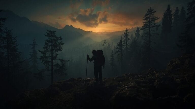
Dead Reckoning Land Navigation: How to Navigate Without GPS, Trail Markers, or Sanity
When your phone dies, your GPS starts spinning like a drunk compass, and the trail you were “pretty sure” existed somehow dissolves into a horror-movie clearing, you’re left with one skill that never glitches, reboots, or demands a software update.
Dead reckoning land navigation.
It’s the ancient, battlefield-tested method of navigating with nothing but direction, distance, stubbornness, and the quiet hope that you won’t walk straight into a ravine. Dead reckoning land navigation is what separates the prepared from the panicked, the competent from the “featured on tomorrow’s news.”
This is land navigation stripped down to the bones — no tech, no trail markers, and sometimes no sanity. Just your brain, your feet, and the confidence of someone who’s watched two YouTube videos and thinks they’re ready for a thru-hike.
Welcome to dead reckoning land navigation — the method that gets you home even when everything else goes full chaos mode.
Your Phone’s Dead, Your Brain’s Panicking, Now What?
Your GPS just froze on “Searching for satellites…”
Your phone is down to 3%.
Your map looks like spaghetti lines drawn by a caffeinated toddler.
And you’re in the woods, at dusk, with rain threatening to turn your hiking boots into small aquariums.
This is where dead reckoning land navigation shines. It’s the navigation method used by soldiers, search-and-rescue teams, and preppers who refuse to be the person featured in tomorrow’s “local hiker rescued again” headline. The U.S. Army still trains every infantry soldier in dead reckoning land navigation because when communications go down and satellites become space debris, this skill keeps people alive.
Mastering dead reckoning land navigation lets you travel straight through dense woods, hit exact targets even with zero visibility, survive a bug-out route when the world goes sideways, and keep your group from turning on each other like it’s Lord of the Flies.
Today, you’ll learn the exact steps, tools, mindset, and mistakes to avoid — so the next time your tech betrays you, you won’t be another statistic.
What Is Dead Reckoning Land Navigation? (Without the Boring Textbook Fluff)
Dead reckoning land navigation is the simplest—and most brutal—form of staying on course.
You pick a direction. You walk that direction. You track your distance. You arrive exactly where you intended — or at least where you meant to end up before that creek crossing tried to swallow your boots.
The term “dead reckoning” likely comes from “deduced reckoning,” though sailors have been arguing about the etymology since before compasses had luminous dials. Some claim the “dead” refers to the dead calm conditions where celestial navigation failed and mariners had to rely purely on their last known position. Either way, the principle remains unchanged whether you’re crossing the Atlantic or the Appalachians.
Dead reckoning land navigation uses azimuth (direction), pace count (distance), terrain association (brains), and landmarks (optional but helpful when you like success).
This is the backbone of military land-nav courses, SAR grids, wilderness recoveries, and bug-out plans. The National Search and Rescue Committee relies on these same principles when coordinating wilderness recoveries. When everything else fails, dead reckoning land navigation doesn’t.
The mathematics behind dead reckoning land navigation are elegantly simple: position equals previous position plus (speed multiplied by time multiplied by direction). In practical terms, you’re constantly updating your estimated location based on where you started, how far you’ve traveled, and what direction you’ve maintained.
Why You Need to Know Dead Reckoning Land Navigation (Yes, Even If You’re “Just Hiking”)
GPS Isn’t Failsafe
Mountains block signals. Dense canopy creates “urban canyon” effects that bounce signals into uselessness. Clouds mess things up. Batteries die faster than your last relationship. And EMPs? Don’t get me started.
The U.S. government’s own GPS.gov admits that standard GPS accuracy is only within 3-5 meters under ideal conditions. In dense forest or mountainous terrain, that error can balloon to 10-15 meters or more. That’s the difference between finding your cache and walking past it three times while cursing.
Solar weather events can degrade GPS accuracy for hours or days. In 2024, a significant geomagnetic storm caused widespread GPS disruptions across North America. Dead reckoning land navigation doesn’t care about solar flares.
Trails Disappear
Flash floods. Snow. Poor maintenance. Or some hiker “fixing” the trail by moving markers around like a bored raccoon with opposable thumbs and questionable judgment.
The Appalachian Trail Conservancy reports that trail conditions change constantly due to weather, seasonal growth, and “improvements” by well-meaning but misguided hikers. What was a clear path in June becomes an overgrown maze by August. Dead reckoning land navigation doesn’t care about vegetation growth cycles.
Panic Makes You Stupid
When fear hits, people walk in giant circles, misread maps, follow “paths” made by deer, and start thinking moss always grows on the north side (false — moss grows wherever it’s damp, which is everywhere in the Pacific Northwest and nowhere useful in the desert).
Research published in the journal Current Biology confirmed what navigators have known for centuries: without external reference points, humans naturally walk in circles. Test subjects who thought they were walking straight lines actually curved up to 20 degrees off course. Your brain literally cannot maintain a straight path without help. Dead reckoning land navigation provides that help through systematic compass checks and pace counting.
Dead reckoning land navigation quiets the chaos. It simplifies everything into “Go this way for this long.” It’s the mental anchor that keeps panic from turning a manageable situation into a survival emergency.
It’s the Backbone of All Serious Navigation
If you can master dead reckoning land navigation, you can handle compass navigation, map reading, grid systems, bug-out planning, SAR operations, and off-trail adventures.
It’s the foundation all those sexy survival skills are built on. Without solid dead reckoning land navigation, your fancy orienteering techniques are just parlor tricks waiting to fail you when the stakes actually matter.
Step-by-Step Instructions: How to Navigate With Dead Reckoning Land Navigation
Below is the Adventure Wiser, step-by-step, no-excuses version of dead reckoning land navigation that’ll get you from point A to point B without becoming a cautionary tale.
Step 1: Determine Your Azimuth (Your Direction of Travel)
Your azimuth is the compass bearing you’ll follow — think of it like choosing a heading on an airplane, except your airplane is your body and it complains more.
An azimuth is measured in degrees from 0 to 360, with north at 0/360, east at 90, south at 180, and west at 270. This angular measurement from north is the foundation of all dead reckoning land navigation.
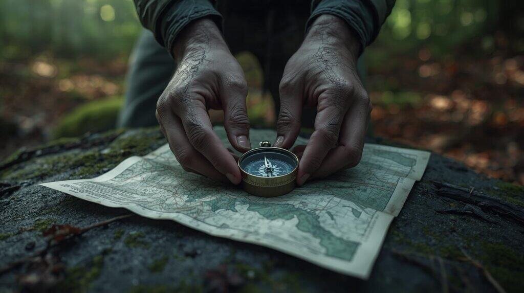
To get an accurate azimuth, hold your compass flat (tilting creates massive errors), point the direction-of-travel arrow toward your intended target, rotate the bezel until the north needle is boxed (“red in the shed”), and read the number your arrow points to.
Boom: that’s your azimuth.
For precision work, use the “center-hold” method taught in military dead reckoning land navigation: hold the compass at waist level with your elbows locked against your body, creating a stable platform. The U.S. Army’s FM 3-25.26 Map Reading and Land Navigation details this technique and several others for different compass types.
A critical note on magnetic declination: your compass points to magnetic north, not true north. Depending on your location, these can differ by 20 degrees or more. The NOAA National Centers for Environmental Information provides current declination values for any location. Ignore declination and your dead reckoning land navigation will drift you miles off course over distance.
This azimuth is your lifeline. Lose it and you are officially “that guy getting rescued.”
Step 2: Pick an Attack Point (or at Least Something That Isn’t a Cloud)
An attack point is a big, obvious landmark near your destination — a technique that separates competent dead reckoning land navigation from wishful thinking.
Good examples include a ridge, a stream crossing, a forest edge, a road, or a noticeable hilltop.
Do NOT pick things like a specific rock, a tree “that looks cool,” a shadow, or a deer you swear will stop running eventually.
The best attack points for dead reckoning land navigation share certain characteristics: they’re large enough to hit even with accumulated error, they’re distinct from surrounding terrain, and they’re visible or detectable from multiple approach angles. A prominent saddle between two peaks beats a single boulder every time.
The concept of “aiming off” enhances attack point navigation in dead reckoning land navigation. Instead of aiming directly at a point on a linear feature (like a bridge on a river), deliberately aim to one side. When you hit the river, you’ll know which direction to turn. Aiming directly means a 50/50 guess when you arrive and find no bridge.
Pick something obvious and hit it with precision.
Step 3: Measure Your Distance With Pace Count
Your pace count is how many steps it takes for you to walk 100 meters — the distance-tracking engine of dead reckoning land navigation.
If you don’t know your pace count yet, go read my guide: “How to Master Pace Count for Land Navigation (Beginner-Friendly Prepper Guide)” — it covers the calibration process in detail.
The average pace count on flat terrain is between 60-70 paces per 100 meters, but this varies significantly with height, stride length, and walking speed. My personal pace count is 66 on flat ground, 72 on moderate uphill, and 58 on descent.
Once you know your pace count, tracking distance in dead reckoning land navigation becomes stupidly easy. If your pace is 66 steps per 100m, and you need to travel 500m, that’s 330 steps. Even your watch can’t screw that up.
For serious dead reckoning land navigation, you need to calibrate multiple pace counts: flat terrain, uphill, downhill, dense vegetation, sand, snow, and while carrying your typical load. A 40-pound pack changes everything.
Step 4: Walk the Line (The Most Important Part)
Here’s how to walk a straight line without looking drunk — the core skill of dead reckoning land navigation:
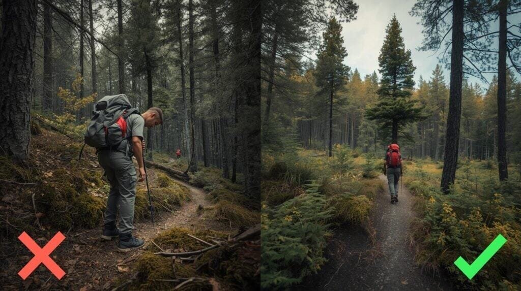
Keep your compass raised and checked often. Sight a distant object on your azimuth (tree, ridge, rock). Walk to it. Re-sight another object. Repeat.
This technique of “steering marks” prevents the classic “gradually drifting left until you’re in a swamp” problem that plagues poor dead reckoning land navigation.
For precision dead reckoning land navigation, especially in limited visibility, use the “leapfrog” method with a partner: send them ahead on your bearing until they’re at the limit of visibility, align them on your azimuth, have them mark the spot, then you walk to them and repeat. This eliminates the cumulative drift that occurs when you’re sighting and walking simultaneously.
At night or in fog, dead reckoning land navigation requires even more discipline. Use shorter segments between steering marks, check your compass more frequently, and consider using your pace count to track even short distances. Visibility of 50 meters or less essentially turns every leg into a precision exercise.
Step 5: Adjust for Obstacles (AKA Don’t Die Over a Log)
Obstacles happen: rivers, cliffs, ravines, angry wildlife, or your own legs deciding to stop cooperating. Handling them properly is what separates functional dead reckoning land navigation from wandering in circles.
Use the “box method” to get around obstacles while maintaining your dead reckoning land navigation integrity:
Turn 90°. Walk a set number of paces. Turn 90° back to your original azimuth. Walk forward until you’ve cleared the obstacle. Turn back 90°. Walk the same number of paces you walked in step 2. Resume original azimuth.
This keeps your track straight without guessing or praying.
For larger obstacles that require significant deviation, the “deliberate offset” method may be more practical: go around, estimate your offset distance, then apply a complementary azimuth and distance to return to your original line.
Document every obstacle deviation in your dead reckoning land navigation log. Memory lies under stress, but your notes don’t.
Step 6: Use Handrails, Backstops & Catch Features
Dead reckoning land navigation isn’t just blind marching. Use terrain like a cheat code.
Handrails are long features you follow beside (rivers, ridgelines, roads, power lines). They reduce your navigation burden by providing a constant reference — you only need to worry about one direction instead of maintaining a precise azimuth. In dead reckoning land navigation, a handrail is like having one wheel on the curb.
Backstops are obvious features you shouldn’t pass (cliff edges, big lakes, major highways). They tell you “if you hit this, you’ve gone too far.” For dead reckoning land navigation, a backstop provides insurance against your accumulated error.
Catch features are specific points that tell you you’ve gone too far on your current leg (streams, roads, saddles). They’re the “you missed your exit” signs of dead reckoning land navigation.
The U.S. Forest Service provides topographic maps that show these features clearly — essential resources for planning dead reckoning land navigation routes before you hit the field.
Using these terrain features transforms dead reckoning land navigation from “hope-based navigation” to systematic, verifiable progress.
Step 7: Keep a Running Log (Because Memory Lies)
Proper dead reckoning land navigation requires meticulous record-keeping. You’re tracking azimuth, pace counts, terrain observations, and landmarks.
Use whatever method you won’t lose: Rite-in-the-Rain notebook, pace beads, a small tally counter, or a grease pencil on your map case.
Your brain will absolutely try to betray you under stress. Studies show that under cognitive load, humans regularly misremember numbers by 10-20%. Write everything down.
A good dead reckoning land navigation log entry looks like this:
Leg 1: Azimuth 045°, Distance 400m, Pace count 264, Start: road junction, End: creek crossing. Notes: terrain rose steadily, adjusted pace to 68/100m.
This log lets you backtrack if needed and verify your position when you encounter identifiable features. It’s the difference between competent dead reckoning land navigation and guessing with style.
Common Mistakes That Make People Very Lost, Very Fast
Check yourself before you wreck yourself — these errors destroy dead reckoning land navigation accuracy:
Common Mistakes That Make People Very Lost, Very Fast
Check yourself before you wreck yourself — these errors destroy dead reckoning land navigation accuracy:
| Mistake | Why It Wrecks You | The Fix |
|---|---|---|
| Not rechecking the compass | Checking once at the start and then pocketing it is not dead reckoning land navigation. It’s gambling. | Check your compass every 50-100 meters and after every obstacle. |
| Watching your feet instead of your bearing | Your feet find every root and rock; your eyes need to maintain your steering mark. | Keep your head up and sight your next steering mark before moving. |
| Not counting paces | “I’ll remember” is famous last words. You won’t. You’ll remember that you forgot, approximately never. | Use pace beads or a tally counter religiously. |
| Guessing distance | Humans consistently underestimate distance traveled, especially in difficult terrain. | Use your calibrated pace count or stay home. |
| Forgetting to update azimuth after detours | If you detour around a swamp, your dead reckoning land navigation doesn’t automatically correct. You have to track and compensate. | Log every deviation and apply the box method for obstacles. |
| Blindly following animal trails | Deer don’t care about your objective rally point. They care about water, food, and avoiding mountain lions. Following their paths leads to their destinations, not yours. | Trust your azimuth over any trail that “looks right.” |
| Relying on “vibes” instead of math | Vibes lie. Compasses don’t. | Make decisions based on azimuth and pace count, not intuition. |
| Neglecting magnetic interference | Metal objects, electronics, and certain rock formations (like those containing magnetite) can deflect your compass. The British Geological Survey explains how local geological anomalies affect compass accuracy. | Keep your compass away from your watch, multitool, and that “lucky” steel flask. |
| Overconfidence in your pace count | Your pace count changes with terrain, fatigue, load, and conditions. Static calibration isn’t enough for reliable dead reckoning land navigation. | Recalibrate for different terrain types and adjust for fatigue. |
Recommended Gear for Dead Reckoning Land Navigation (AW Style)
Here’s the gear I actually trust for dead reckoning land navigation:
Cammenga 3H Lensatic Compass — Battle-proven military compass. Tritium illumination for night work. Practically unkillable. This is the compass the U.S. military issues because it survives things that destroy lesser instruments. For serious dead reckoning land navigation, accept no substitutes.
Suunto MC-2 — Mirror compass for precision navigation and declination adjustments. The mirror lets you sight distant objects while viewing the dial simultaneously — invaluable for accurate dead reckoning land navigation over long distances.
Pace Beads — Cheap but lifesaving. Keeps you honest on distance. Ranger beads typically have 9 beads on one section (for 100m increments) and 4 on another (for kilometers). For dead reckoning land navigation, these are more reliable than mental counting under stress.
Rite-in-the-Rain Notebook & Pencil — Durable, waterproof logging for azimuths, pace counts, and notes. Your dead reckoning land navigation log is useless if it dissolves in the first rain.
UTM Grid Reader — For those integrating dead reckoning land navigation with map work, a grid reader speeds up coordinate plotting and reduces errors.
Garmin Instinct 2 (Backup Only) — If you do carry GPS, keep it turned off until needed. Dead reckoning land navigation is primary. GPS is verification, not navigation.
Key Considerations (AKA How Not to End Up on the News)
Practice before you need it — don’t learn dead reckoning land navigation during a storm. Find a local park with good map coverage and practice until the skills are automatic.
Your pace count changes with terrain — steep equals more steps. Also adjust for dense vegetation, snow, sand, and fatigue. Reliable dead reckoning land navigation requires current calibration.
Weather can affect precision — fog, rain, and high wind make sighting difficult and can accelerate fatigue. Reduce leg distances in poor conditions.
Fatigue ruins accuracy — rest often. A tired navigator makes errors that compound over distance. Better to stop 10 minutes than wander 10 hours.
Dead reckoning land navigation gets you close, not perfect — combine it with terrain association. Accumulated error is inherent in the method. Plan your route to use catching features that will tell you when you’ve reached your objective area.
Practice in varied conditions — daylight dead reckoning land navigation is training wheels. Night navigation, bad weather, and unfamiliar terrain are where this skill proves its worth.
Going Further (Advanced Techniques for Serious Preppers)
Once you master basic dead reckoning land navigation, level up with these advanced techniques:
Triangulation — Using multiple bearings from known points to pinpoint your location. This integrates with dead reckoning land navigation to provide position verification.
Resection and Intersection — Related techniques for determining unknown positions using known features. The National Wildfire Coordinating Group publishes training materials on these methods used by wildland firefighters.
Direct line navigation with micro-sight points — Using very short legs and precise compass work for navigation through featureless terrain.
Night navigation (red light only) — Preserving night vision while maintaining dead reckoning land navigation accuracy. This requires modified techniques and additional practice.
Declination conversion for map work — Converting between magnetic, grid, and true north for seamless integration of compass and map.
Grid vs magnetic azimuth mastery — Understanding when to use each and how to convert between them. Critical for combining dead reckoning land navigation with UTM grid systems.
Combining dead reckoning land navigation with GPS verification only — Using GPS to confirm position without depending on it for navigation.
Building your own land nav course — Creating practice routes to develop and maintain skills.
Speed vs precision trade-offs — Learning when to prioritize pace and when to prioritize accuracy in your dead reckoning land navigation.
This is where dead reckoning land navigation stops being a survival skill and becomes a superpower.
Wrapping Up & My Experience With Dead Reckoning Land Navigation
Dead reckoning land navigation is the one skill that kept me from walking in circles, getting turned around in dense Ouachita woods, missing key features on night hikes, and once, accidentally walking into a campsite of drunk anglers at 2am (that was awkward for everyone, especially the guy who wasn’t wearing pants).
The Navy taught me that dead reckoning land navigation isn’t just a backup skill — it’s the foundation everything else builds on. Twenty years later, I still practice it regularly because skills decay without use, and this is one skill I never want to need and not have.
It’s simple. It’s reliable. And it doesn’t care if your phone battery is at 3% or 0%.
Master dead reckoning land navigation and suddenly you’re the friend everyone trusts when the trail vanishes and the trees start all looking the same. You’re the person who gets the group home instead of being the person who gets the group lost.
Start with short practice routes in familiar territory. Build your skills systematically. Calibrate your pace count for different conditions. Keep a navigation log until it’s second nature.
Because when the satellites go dark and the batteries die and the trail dissolves into dense undergrowth, dead reckoning land navigation will still work. It always does.
And that’s the kind of reliability you can literally bet your life on.
Keep Leveling Up Your Land Nav Skills:
- Pace Counting for Land Navigation: Stop Getting Lost when GPS Fails
- Best Compasses for Preppers in 2025 (Reliable Picks You Can Trust)
- Best Maps for Preppers: Topographic & Survival Maps You Can Trust in 2025
- Building a DIY Land Nav Kit That Fits in Your Glovebox
Heads-Up, Fellow Preppers: Some links in this post are sponsored or affiliate links. If you click and buy, I may earn a small commission—enough to keep testing gear and writing honest reviews. I only recommend radios I’ve personally field-tested and would trust in actual emergencies.