
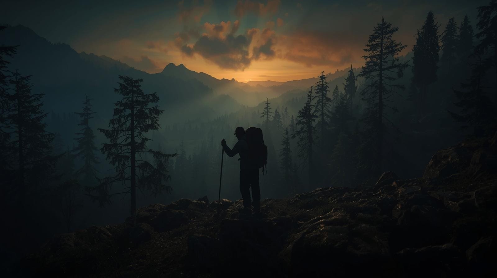
How To Navigate Without a Compass (Without Crying, Panicking, or Calling Your Mom)
Your phone’s dead, your GPS is spinning like a drunk ceiling fan, and your fancy compass is… at home… sitting on your desk… right next to the snacks you also forgot. Now you’re standing in the woods trying to figure out which direction won’t lead you straight into a ravine. Congratulations—you’ve just discovered why learning to navigate without a compass isn’t optional anymore.
Good news: humans navigated the planet just fine for thousands of years without compasses, satellites, or apps that shout “make a U-turn.” The ability to navigate without a compass separates those who walk out of the woods from those who become a cautionary tale around the campfire. Nature is basically a big, sarcastic map if you know what to look for—and these techniques have been refined by everyone from ancient mariners to modern military personnel.
Imagine being the person who can stay oriented even when everything fails—in storms, blackouts, lost-trails, or on that “shortcut” your buddy swears “totally reconnects with the main path.” (It doesn’t.) When you learn to navigate without a compass, you turn from “lost hiker” into “human GPS,” minus the annoying recalculating voice. These aren’t party tricks—they’re the same field-expedient methods taught in Army field manuals and used by wilderness survival instructors worldwide.
Grab your brain, your eyeballs, and maybe a stick. Let’s learn to navigate without a compass like the old-school pros: simple systems, real-world signs, zero tech.
What Is No-Compass Navigation?
When we talk about the ability to navigate without a compass, we’re talking about the art of staying oriented using nature, terrain, the sun, stars, wind, shadows, and common sense instead of tools. This isn’t wilderness wizardry—it’s structured observation backed by centuries of survival, exploration, and military land-nav principles.
At its core, learning to navigate without a compass comes down to three things:
- Finding direction using natural indicators
- Keeping direction using terrain features
- Moving with purpose instead of wandering like a confused raccoon
The techniques you’ll learn here come straight from sources like the U.S. Army Field Manual FM 3-25.26 on Map Reading and Land Navigation, which has been teaching soldiers to navigate without a compass for decades. If it’s good enough for soldiers operating in hostile terrain with zero margin for error, it’s good enough for your weekend camping trip.
Reasons You Need to Know How to Navigate Without a Compass
Because batteries die. Usually the moment you brag about your battery life.
Because storms kill GPS accuracy. Ask any Search & Rescue tech. Cloud cover, dense tree canopy, and electronic interference can turn your GPS into an expensive paperweight right when you need it most.
Because panic makes people walk in circles. This isn’t an old wives’ tale—it’s been proven through scientific research. A study by Jan Souman at the Max Planck Institute for Biological Cybernetics found that when people lose visual cues like the sun or distant landmarks, they begin walking in circles without even realizing it. The researchers used GPS to track participants walking in the Sahara desert and a German forest—when the sun disappeared behind clouds, subjects walked in tight loops, sometimes crossing their own paths within minutes. Understanding how to navigate without a compass gives you the tools to overcome this hardwired human tendency.
Because every prepper needs backup skills. Tools break. Skills don’t. Your compass can crack, lose its fill, or demagnetize. Your ability to navigate without a compass stays with you forever.
Because you can’t always rely on electronics in emergencies. Grid down = “welcome back to the 1800s, friend.” Whether it’s an EMP, solar flare, or just Murphy’s Law, when the grid goes dark, those who can navigate without a compass will be the ones leading the way out.
Because it makes you instantly more capable outdoors. Hiking, hunting, bug-outs, night land nav, you name it. When you can navigate without a compass, you’re no longer dependent on any single piece of gear.
Step-by-Step Instructions: How to Navigate Without a Compass
Step 1: Use the Sun (The Original GPS)
The sun rises in the east, sets in the west, and moves east → west across the sky. That gives you a rough directional frame immediately. But “rough” doesn’t cut it when you’re actually trying to navigate without a compass in unfamiliar terrain—you need something more precise.
Shadow Stick Method (For More Accuracy)
This technique comes directly from military field manuals and has been used to navigate without a compass for centuries. According to Army FM 3-05.70 (Survival), here’s how it works:
- Find a straight stick about 1 meter (3 feet) long and a level spot free of brush where it will cast a definite shadow.
- Place the stick upright in the ground.
- Mark the tip of the shadow with a stone, twig, or other marker (Point A). This first shadow mark is always west—everywhere on earth.
- Wait 10–15 minutes until the shadow tip moves a few inches (centimeters).
- Mark the new shadow tip (Point B). This mark represents east.
- Draw a line from A → B. This line runs west → east.
- Stand with A (west) on your left, B (east) on your right.
- You are now facing north.
This fact is true everywhere on earth—it’s one of the most reliable ways to navigate without a compass in any hemisphere.
Why This Works:
Shadows move in the opposite direction of the sun. In the Northern Hemisphere, they move from west to east and point north at noon. In the Southern Hemisphere, shadows indicate south at noon. When you navigate without a compass using the shadow stick method, you’re essentially using the Earth’s rotation as your directional reference.
Pro Tip:
The shadow-tip method can also be used as a shadow clock to find the approximate time of day. Move the stick to the intersection of the east-west and north-south lines—the west part indicates 0600 hours, and the east part indicates 1800 hours, anywhere on earth. This dual-purpose technique makes it invaluable when you need to navigate without a compass and track time simultaneously.
Alternate Method (More Accurate but Time-Intensive):
For even greater precision when you navigate without a compass, set up your shadow stick in the morning and mark the first shadow. Use a piece of string to draw a clean arc through this mark and around the stick. At midday, the shadow will shorten and then lengthen again—mark where it touches the arc in the afternoon. A line between these two marks gives you a more accurate east-west line.
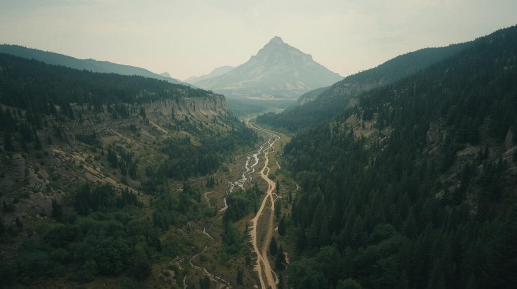
Step 2: Use Land Features (Your Terrain Handrails)
Terrain doesn’t lie. It also doesn’t run out of battery. When you navigate without a compass, terrain association becomes your most reliable ally.
According to U.S. Army doctrine on terrain association, the key is learning to read the landscape the way you’d read a map—identifying features that can guide your movement, warn you when you’ve gone too far, or help you maintain your heading.
Look for:
- Ridges (run in predictable directions and offer excellent vantage points)
- Valleys (tend to funnel you—use them as natural highways)
- Rivers/streams (usually flow downhill and often toward civilization)
- Mountain silhouettes (distinct shapes that can anchor your bearing)
- Roads/cut lines (rarely random—they go somewhere)
Key Concepts for Terrain-Based Navigation:
When you navigate without a compass, you’ll want to understand three critical concepts from military land navigation:
- Handrails: Linear features like roads, streams, ridgelines, or power lines that run roughly parallel to your direction of travel. These keep you oriented without requiring constant attention. Think of them as guardrails for your route—you can move quickly while they keep you on track.
- Catching Features: Prominent features that alert you when it’s time to change direction or warn you that you’ve gone too far. When you navigate without a compass, catching features act as your stop signs. A perpendicular road, a river that crosses your path, or a distinct ridge can all serve this purpose.
- Attack Points: Easily identifiable features close to your final objective that you use as a jumping-off point for precision navigation. You navigate without a compass to the attack point using terrain association, then switch to dead reckoning for the final approach.
Field Tip:
Pick a far-off feature like a mountain notch, rock formation, or tall tree. Walk toward it. Don’t stop staring at it like it owes you money. When you reach your feature, select a new one that maintains your direction of travel. This point-to-point method is one of the most effective ways to navigate without a compass over long distances.
Step 3: Follow the Wind (Directional Clues Hidden in Airflow)
Wind is not perfectly reliable—storms, valleys, and thermals can change it—but it still gives clues when you need to navigate without a compass.
Here’s how:
- In many areas, prevailing winds stick to consistent patterns. Before you head out, learn the dominant wind direction for your region and season.
- Tree shaping (flagging) occurs when wind blows from the same direction for years.
- Wind-facing side = stunted, rough growth, branches bent away from wind
- Opposite side = fuller growth, natural branch development
This is most obvious in exposed areas—ridgelines, coastlines, or high plains where there’s nothing to block the wind. When you navigate without a compass, a line of flagged trees can confirm your other directional observations.
Understanding Prevailing Winds:
In the continental United States, prevailing winds generally blow from west to east. However, local terrain significantly affects wind patterns. Valleys channel wind along their length, mountains create upslope and downslope patterns, and bodies of water generate their own circulation. When you navigate without a compass using wind, you’re looking for long-term patterns etched into the landscape, not the direction of today’s breeze.
Field Tip:
Don’t rely on wind alone. Use it to confirm other indicators, not replace them. Wind direction can change with weather fronts, time of day (thermal winds), and local terrain features. When you navigate without a compass, redundancy is your friend—cross-reference everything.
Step 4: Read Vegetation & Growth Patterns (Nature’s Subtle Hints)
Vegetation grows differently depending on sun exposure, and understanding these patterns helps you navigate without a compass by giving you subtle directional cues.
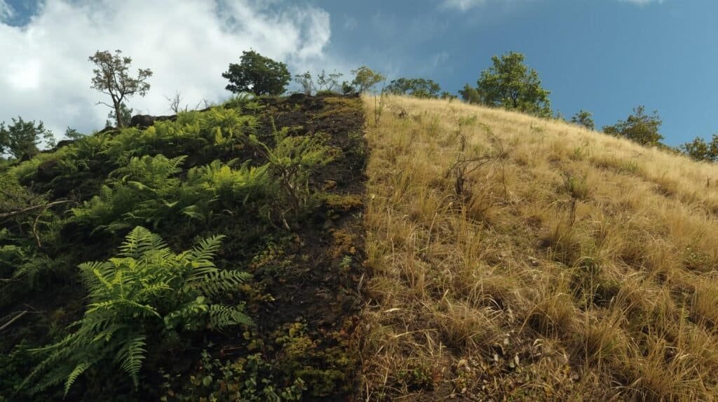
North-facing slopes (in the Northern Hemisphere):
- Cooler, wetter, receive less direct sunlight
- More moss, more ferns, darker and damper soil
- Trees often taller and less dense
South-facing slopes:
- Hotter, drier, receive more direct sunlight
- Grassier, sparser vegetation, lighter soil
- Trees often shorter and more widely spaced
The Moss Myth—Corrected:
You’ve probably heard “moss grows on the north side of trees.” This is half-true, which makes it dangerous when you’re trying to navigate without a compass. Here’s the reality:
Moss grows wherever it’s moist and shaded. That’s often (but not always) the north side of trees in the Northern Hemisphere, because the north side gets less direct sunlight and stays damper. However: in dense forests, moss grows everywhere because the whole forest floor is shaded. Near streams, moss grows on all sides. In wet climates, moss couldn’t care less about direction.
How to Actually Use Moss:
When you navigate without a compass using moss as an indicator, look for patterns across multiple trees, not just one. If you see consistently thicker, greener moss on the same side of most trees in an area, that’s likely north. Single observations mean nothing—the pattern matters.
Field Tip:
Use slope differences for macro-navigation (overall direction of travel). Use vegetation patterns for micro-confirmation. Neither should be used as your primary method to navigate without a compass—they’re supporting evidence, not primary evidence.
Step 5: Use the Stars (Night Navigation Without Crying)
When the sun goes down, the stars come out to play—and they’ve been helping humans navigate without a compass for thousands of years. Polaris, the North Star, has guided everyone from ancient mariners to modern special operations teams, and it can guide you too.
Find North Using Polaris
Unlike other stars that move across the sky as Earth rotates, Polaris appears to stay fixed because it sits almost directly above Earth’s North Pole. Only about 0.7 degrees separates Polaris from true north—less than the width of 1.5 full moons. When you navigate without a compass at night, Polaris is your anchor.
Here’s how to find it:
- Find the Big Dipper (Ursa Major)—it looks like a giant kitchen ladle with four stars in the bowl and three in the handle. Even if you’ve never consciously looked for it, you’ve probably seen it. It’s one of the most recognizable star patterns in the Northern Hemisphere.
- Locate the “Pointer” stars—these are the two stars (Dubhe and Merak) that form the outer edge of the Big Dipper’s bowl, farthest from the handle.
- Draw an imaginary line through these two stars, extending from the bottom of the bowl through the top.
- Follow that line upward approximately five times the distance between the two pointer stars.
- The first bright star you hit is Polaris—it’s the tip of the handle of the Little Dipper (Ursa Minor).
When you navigate without a compass using Polaris, you’re looking at true north. This is actually more accurate than a magnetic compass, which points to magnetic north and requires declination correction.
No Big Dipper? Use Cassiopeia:
The Big Dipper isn’t always high in the sky—in autumn evenings, it swings low toward the horizon and can be hard to see from lower latitudes. When this happens, look for Cassiopeia, the W-shaped constellation on the opposite side of Polaris from the Big Dipper. When Cassiopeia is easier to find than the Big Dipper, you can still navigate without a compass by using it to triangulate Polaris’s position—it’s roughly equidistant between the two constellations.
Southern Hemisphere?
You can still navigate without a compass using stars—just different ones. Use the Southern Cross (Crux) constellation:
- Find the four bright stars that form the cross.
- Extend the long axis of the cross about 4.5 times its length.
- That point is approximately true south.
Since there’s no bright star marking the South Celestial Pole (unlike Polaris in the north), you’ll need to identify the point in space and mark it against the horizon.
Field Tip:
If clouds block stars, shift to terrain association or dead reckoning. Never rely on a single method to navigate without a compass—environmental conditions change, and you need backup systems. Also, remember that the Big Dipper rotates counterclockwise around Polaris throughout the night and across seasons, so its orientation will look different at different times—but its relationship to Polaris never changes.
Step 6: Dead Reckoning (Walk Straight Without Wobbling Like a Shopping Cart)
Dead reckoning is one of the oldest navigation methods in human history—it’s how Columbus crossed the Atlantic, how early aviators found their way before GPS, and how military personnel navigate without a compass in low-visibility conditions.
Dead reckoning = Pick a direction → Walk that direction → Count distance → Don’t drift like a moron.
This sounds simple, but the reason it has its own chapter in military field manuals is because humans are spectacularly bad at walking straight. Remember that Max Planck Institute study? Without visual cues, we walk in circles—sometimes crossing our own paths within minutes—due to subtle biomechanical asymmetries we don’t even notice.
When you navigate without a compass using dead reckoning, here’s how to stay on course:
- Pick a landmark directly in line with your direction of travel. Make it distinctive—a uniquely shaped tree, an unusual rock, a notch in a ridge.
- Walk to that landmark. Keep your eyes on it. Don’t get distracted. Don’t “shortcut” around obstacles in ways that change your direction.
- When you reach it, turn around and find a back reference—a landmark in the opposite direction that lets you confirm your line of travel.
- Pick the next landmark by extending that same line forward.
- Repeat.
This technique reduces drift and keeps you from doing the “lost hiker spiral” that search and rescue teams know all too well.
Pace Counting:
When you navigate without a compass over long distances, you need to track how far you’ve traveled, not just what direction you’re going. Pace counting helps you do that:
- Determine your personal pace count (how many paces it takes you to cover 100 meters on flat terrain). For most people, this is 60-70 double-paces (counting only when one foot, usually the left, hits the ground).
- Adjust for terrain—add 10-20% for slopes, rough ground, or heavy vegetation.
- Use pace count beads or transfer small pebbles between pockets to track each 100-meter increment.
Combined with direction control, pace counting lets you navigate without a compass with surprising precision—military personnel routinely hit targets within 10 meters using nothing but dead reckoning.
Step 7: Track Your Shadows (Daylight Course Keeping)
Once you’ve established your initial direction using the shadow stick method, you can use ongoing shadow changes to navigate without a compass throughout the day.
Your shadow moves as the sun moves:
- Morning → Long shadows pointing west
- Midday → Shadows short, pointing north (Northern Hemisphere)
- Late Afternoon → Long shadows pointing east
If you know the rough time of day, you can use shadow length + direction shifts to maintain orientation.
Here’s how it works in practice:
Let’s say you determined north using the shadow stick method early in the morning, and you need to travel northwest. As the sun rises and moves across the sky, your shadow changes predictably. In mid-morning, if you keep your shadow at roughly 45 degrees to your right, you’re maintaining your northwest heading.
By noon, your shadow points north (it’s short, straight behind you if you’re facing south, or straight in front if you’re facing north). To continue northwest, keep your shadow slightly to your right rear.
In the afternoon, shadows grow and swing east. Adjust your body position relative to your shadow to maintain your heading.
This isn’t precision navigation—but when you navigate without a compass, “close enough” is often good enough to keep you moving in the right general direction until you hit a catching feature or can take another shadow stick reading.
Field Tip:
Take shadow stick readings at regular intervals—morning, midday, and afternoon at minimum. This corrects for errors that accumulate when you navigate without a compass using only shadow tracking, and gives you confirmed reference points you can navigate between with confidence.
Step 8: Follow Water Downhill (Especially in Survival Situations)
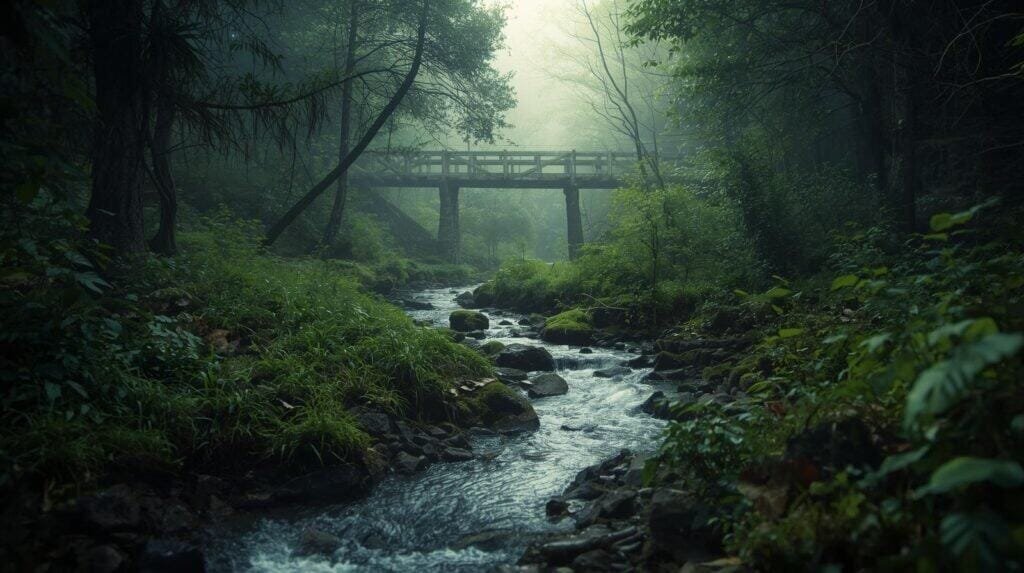
Water moves downhill. Civilization is almost always near water.
This is less of a directional technique and more of a survival strategy, but when you’re well and truly lost and your primary goal shifts from “reach my destination” to “get somewhere with other humans,” following water is often your best bet.
The logic:
- Small streams → converge into larger streams
- Larger streams → converge into rivers
- Rivers → have bridges, roads, towns, farms along them
Follow streams → converge into larger streams → rivers → bridges → roads → towns.
When you navigate without a compass in a true survival situation, following water downstream combines direction, progress toward civilization, and access to a critical resource for hydration.
Important Caveats:
This is not a perfect direction system. Streams meander, loop, and sometimes lead into swamps or canyons. In some wilderness areas, following water can take you deeper into uninhabited terrain before it leads anywhere useful.
Use this strategy when:
- You have no idea where you are
- You’ve been lost long enough that your original destination is no longer relevant
- You need water and might as well travel along your water source
Don’t use it when:
- You know your approximate location and can navigate without a compass toward a closer road or trailhead
- Following water would take you away from areas where searchers might look for you
- Terrain makes stream-following dangerous (waterfalls, canyons, etc.)
Key Considerations

Stay Calm—Panic Makes You Walk in Circles
This is well-studied and documented. When people panic, they lose the ability to navigate without a compass effectively—or navigate at all. The research shows that without external directional cues like the sun, humans start to drift left or right, and that drift accumulates until you’re walking in circles. Some researchers attribute this to leg-length differences, stride asymmetries, or cerebral hemisphere dominance. Whatever the cause, the result is the same: panic = circles = you’re toast.
Slow down. Breathe. Observe.
When you first realize you’re disoriented, stop. Don’t take another step in any direction until you’ve done a conscious mental reset. Sit down if you need to. Drink some water. Eat something. Panic burns energy and clouds judgment—both of which you can’t afford when you need to navigate without a compass out of a bad situation.
Once you’re calm, assess what you have to work with. What’s the sun doing? Where are distant landmarks? What terrain features can you identify? Only then should you start moving—deliberately, with a plan, using the techniques in this guide.
Use Multiple Indicators, Not Just One
Nature lies sometimes. Clouds block the sun. Fog obscures landmarks. That one tree has moss growing all over it because it’s next to a stream. When you navigate without a compass, you need redundancy—multiple indicators that all point the same direction give you confidence that you’re right.
The shadow stick says north is there. The distant mountain peak confirms it. The moss pattern supports it. Now you can move with confidence.
If your indicators disagree? Stop and figure out why. One of them is giving you bad information. Trust the most reliable source (shadow stick over moss, landmark over wind) and move cautiously until you can get more data.
Know When to Stay Put
Search & Rescue has a much easier time finding a stationary person.
Here’s the uncomfortable truth: if you navigate without a compass and you’re still lost after a good-faith effort, you might not be lost because you lack skills. You might be lost because the terrain is genuinely confusing, visibility is shot, or you’re injured/exhausted/in no shape to make good decisions.
If conditions worsen → stop moving → build shelter → wait.
This is especially true if:
- People know roughly where you were supposed to be
- You have shelter-building materials and water
- Weather or daylight is getting worse, not better
Moving when you can’t effectively navigate without a compass just takes you farther from where searchers are looking. Pride has gotten more people killed in the wilderness than incompetence ever has.
Going Further and Alternatives
So you’ve mastered how to navigate without a compass—what’s next?
Learn map & terrain association (with or without a compass) Understanding how to read topographic maps and correlate them with the terrain around you is the master skill of land navigation. When you can visualize what the map is showing you and match it to what you see, you’ll never be truly lost again—with or without a compass.
Practice back azimuths using only landmarks A back azimuth is the reverse of your direction of travel—if you’re heading north, your back azimuth is south. When you navigate without a compass, periodically turn around and identify landmarks behind you. If you need to retrace your route, those landmarks become your forward references.
Learn star hopping for night navigation Beyond just finding Polaris, learn to identify multiple constellations and how they move across the sky. Orion rises in the east and sets in the west—you can use its position and angle to estimate direction throughout the night. The more celestial references you know, the better you can navigate without a compass after dark.
Take a basic land nav course Nothing beats learning from experienced instructors who can watch you make mistakes and correct them on the spot. Many outdoor schools, military veteran organizations, and prepper groups offer land navigation courses.
Carry a backup compass Yes, this whole article is about how to navigate without a compass. Yes, you should still carry one. Even a tiny button compass tucked in your kit is better than nothing. The point of learning to navigate without a compass isn’t to never use one—it’s to have options when your primary gear fails.
Wrapping Up & My Experience
I’ve navigated trails where the map made no sense, the fog rolled in, and the terrain felt like Mother Nature was drunk and trying to gaslight me. I’ve been in situations where the compass I was carrying was the problem, not the solution (magnetic anomalies are real, and they’re annoying). The people who stay oriented aren’t the ones with the fanciest gear—it’s the ones who know how to navigate without a compass when the situation demands it.
These aren’t theoretical skills I read about in a book and thought “neat.” They’re methods I’ve used, taught, and trusted when getting it wrong meant a very long night—or worse.
Learn these skills and you won’t fear “getting lost” anymore. You’ll know how to:
- Stay oriented with confidence using sun, stars, terrain, and natural indicators
- Move purposefully with redundant systems that confirm each other
- Get yourself (and others) out safely even when electronics and equipment fail
- Thrive in conditions that would paralyze someone dependent on their phone
Gear fails. Skills don’t. And if you’re building your prepping foundation, knowing how to navigate without a compass is one of the most important capabilities you’ll ever develop.
The ability to navigate without a compass connects you to thousands of years of human survival knowledge—from ancient mariners eyeing Polaris on trackless oceans to Army Rangers moving through hostile terrain with nothing but map, moon, and mission. That knowledge is your birthright. Learn it. Practice it. Trust it.
Because the woods don’t care about your warranty, and the stars don’t care about your excuses.
More Articles Like This (Highly Recommended)
Dead Reckoning Navigation: The Ancient Skill Every Prepper Should Master
Learn how to track direction and distance even in total darkness.
Land Navigation for Real Life: How Not to Get Lost and Cry in the Woods
Your complete navigation toolbox — step-by-step.
Magnetic Azimuths for Preppers: The Essential Guide to Mastering Bearings in 2025
Finally understand all the squiggly lines on those maps hikers pretend to read.
External Resources
- U.S. Army FM 3-25.26: Map Reading and Land Navigation – The military’s official field manual on navigation techniques, including field-expedient methods when you need to navigate without a compass.
- Polaris: How to Find the North Star (Space.com) – Comprehensive guide to celestial navigation using Polaris.
- Max Planck Institute Study on Walking in Circles – The scientific research proving why humans walk in circles when lost and can’t navigate without a compass or visual references.
- U.S. Army Terrain Association Navigation (FM 3-25.26) – Detailed military doctrine on using terrain features as your primary navigation method.
- The Natural Navigator: How to Navigate Using Stars – Excellent civilian resource for celestial navigation techniques.